Log in
All resources
Create a design
7,085 Free Images of Atlas Map
copper engraving print
joan blaeu
british library
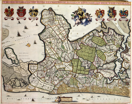
maps from university of amsterdam special collections
atlas der neederlanden
copperplate print
special collections of the university of amsterdam
atlas der neederlanden deel iii: holland 2. zuid-holland
nicolaas samuel crucquius
old maps of delfland
gemeente atlas van nederland - south holland
1860s maps of south holland
gemeente atlas van nederland - north holland
maps of diemen
atlas maior, vol 5 (england) - joan blaeu, 1667 - bl 114.h(star).5
17th-century maps of cumberland
atlas maior, vol 5 (england) - joan blaeu, 1667 - bl 114.h(star).5
17th-century maps of kent
atlas maior, vol 5 (england) - joan blaeu, 1667 - bl 114.h(star).5
17th-century maps of cardiganshire
atlas maior, vol 5 (england) - joan blaeu, 1667 - bl 114.h(star).5
17th-century maps of surrey
atlas maior, vol 5 (england) - joan blaeu, 1667 - bl 114.h(star).5
17th-century maps of wiltshire
atlas maior, vol 5 (england) - joan blaeu, 1667 - bl 114.h(star).5
17th-century maps of suffolk
atlas maior, vol 5 (england) - joan blaeu, 1667 - bl 114.h(star).5
17th-century maps of norfolk, england
gemeente atlas van nederland - gelderland
netherlands in the 1860s
18th-century maps of the strait of magellan
1700s maps of argentina
gemeente atlas van nederland - south holland
1860s maps of south holland
old maps of trinidad and tobago
17th-century maps of venezuela
atlas maior, vol 5 (england) - joan blaeu, 1667 - bl 114.h(star).5
17th-century maps of gloucestershire
atlas maior, vol 3 (germany) - joan blaeu, 1667 - bl 114.h(star).3
17th-century maps of silesia
atlas maior, vol 5 (england) - joan blaeu, 1667 - bl 114.h(star).5
17th-century maps of hampshire
atlas maior, vol 6 (scotland and ireland) - joan blaeu, 1667 - bl 114.h(star).6
1667 maps
atlas maior, vol 9 (italy) - joan blaeu, 1667 - bl 114.h(star).9
1667 maps of italy
atlas maior, vol 12 (america) - joan blaeu, 1667 - bl 114.h(star).12
1667 maps
atlas maior, vol 5 (england) - joan blaeu, 1667 - bl 114.h(star).5
17th-century maps of cornwall
atlas maior, vol 9 (italy) - joan blaeu, 1667 - bl 114.h(star).9
1667 maps of italy
russian empire in thomas kitchen's general atlas (1773)
general atlas (1773)
atlas maior, vol 6 (scotland and ireland) - joan blaeu, 1667 - bl 114.h(star).6
1667 maps
gemeente atlas van nederland - south holland
1860s maps of south holland
19th-century maps of south holland
maps of veur
1860s maps of china
1863 maps of asia
maps by willem and johannes blaeu
1648 maps of africa
atlas van der hagen (volume 4)
atlas van der hagen
maps of paris from the david rumsey historical map collection
maps of paris by caspar merian
vesting bourtange
atlas van loon
maps made in the 17th century
old maps of sicily
gemeente atlas van nederland - south holland
19th-century maps of rotterdam
turgot map of paris, norman b. leventhal map center
sheet 19 of the turgot map of paris
gemeente atlas van nederland - south holland
1860s maps of south holland
atlas van der hagen (volume 2)
1680s maps of the netherlands
maps from university of amsterdam special collections
atlas der neederlanden
eric (xii) of sweden (erik magnusson)
maps of the history of sweden
gemeente atlas van nederland - north holland
old maps of beverwijk
gemeente atlas van nederland - south holland
1860s maps of south holland
maps from university of amsterdam special collections
atlas der neederlanden
miniature speed atlas (1627) pieter van den keere
maps of wales by john speed
1602 in the netherlands
siege of grave 1602
17th-century maps of crimea
1640s maps of ukraine
old maps of damme
atlas van loon
atlas van loon
festung jülich
maps of paris from the barry lawrence ruderman antique maps inc.
key sheet of the turgot map of paris
grosser deutscher atlas
1790s maps of ireland
maps from university of amsterdam special collections
atlas der neederlanden
maps from university of amsterdam special collections
atlas der neederlanden
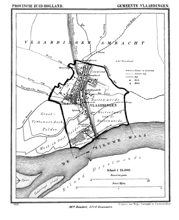
gemeente atlas van nederland - south holland
old maps of vlaardingen
gemeente atlas van nederland - south holland
1860s maps of south holland
maps of the history of palestine
1880s maps of palestine
maps from university of amsterdam special collections
atlas der neederlanden
maps from university of amsterdam special collections
atlas der neederlanden
maps from university of amsterdam special collections
atlas der neederlanden
maps from university of amsterdam special collections
atlas der neederlanden
maps from university of amsterdam special collections
atlas der neederlanden
maps from university of amsterdam special collections
atlas der neederlanden
maps by willem and johannes blaeu
1662
continent
maps
old maps of north rhine-westphalia
maps of the county of mark
coats of arms on maps
ships on maps
nouvel atlas de la chine
claas condet
atlas du canton de paris, 1795
plan de roussel
grosser deutscher atlas
1794 maps of europe
gemeente atlas van nederland - south holland
1860s maps of south holland
gemeente atlas van nederland - south holland
1860s maps of south holland
maps from university of amsterdam special collections
atlas der neederlanden
maps from university of amsterdam special collections
atlas der neederlanden
maps from university of amsterdam special collections
atlas der neederlanden
maps from university of amsterdam special collections
atlas der neederlanden
maps from university of amsterdam special collections
atlas der neederlanden
maps from university of amsterdam special collections
atlas der neederlanden
maps from university of amsterdam special collections
atlas der neederlanden
maps from university of amsterdam special collections
atlas der neederlanden
maps from university of amsterdam special collections
atlas der neederlanden
maps from university of amsterdam special collections
atlas der neederlanden
maps of the ottoman empire by mercator-hondius
1640s maps of the tsardom of russia
17th-century maps of circassia
gemeente atlas van nederland - south holland
1860s maps of south holland
17th-century maps of herefordshire
1646 maps
map collection of leibniz-institut für länderkunde
1603 in art
atlas maior, vol 1 (northern europe, norway, and denmark) - joan blaeu, 1667 - bl 114.h(star).1
17th-century maps of iceland
atlas maior, vol 5 (england) - joan blaeu, 1667 - bl 114.h(star).5
17th-century maps of yorkshire
atlas maior, vol 7 (france i) - joan blaeu, 1667 - bl 114.h(star).7
1667 maps
miniature speed atlas (1627) pieter van den keere
old county maps of leicestershire
atlas sive cosmographicae (gerardus mercator, 1596)
hendrik hondius the younger
atlas maior, vol 10 (spain and africa) - joan blaeu, 1667 - bl 114.h(star).10
1667 maps
miniature speed atlas (1627) pieter van den keere
county maps of england by john speed
miniature speed atlas (1627) pieter van den keere
county maps of england by john speed
miniature speed atlas (1627) pieter van den keere
county maps of england by john speed
miniature speed atlas (1627) pieter van den keere
county maps of england by john speed
locator maps of the harbour of rotterdam
glashaven (canal in rotterdam)
grosser deutscher atlas
old maps of switzerland
maps by thomas kitchin
andrew dury
alphonsus lasor a varea
maps by jodocus hondius
17th-century maps of southeast asia
maps by jodocus hondius
ancienne église saint-hippolyte de paris
churches on turgot map of paris
gemeente atlas van nederland - south holland
1860s maps of south holland
atlas ou representation du monde universel t. 2 (1633)
maps by hendrik hondius the younger
1901 - 2000 of 7,085
Next page
/ 71


![Map of Paraguay, Chile, and Strait of Magellan - Guillaume de L'Isle, [1703-1708]](https://cdn.creazilla.com/illustrations/10001534848/map-of-paraguay-chile-and-strait-of-magellan-guillaume-de-lisle-1703-1708-sm.webp)


![Map or drawing of the river Merwede from Gorichem downwards etc. / [Nicolaes Cruquius], [1730]](https://cdn.creazilla.com/illustrations/10001419622/map-or-drawing-of-the-river-merwede-from-gorichem-downwards-etc-nicolaes-cruquius-1730-sm.webp)


![Map of Ceylon - European Colonial Establishments, Jakob van der Schley, [1750]](https://cdn.creazilla.com/illustrations/10000562848/map-of-ceylon-european-colonial-establishments-jakob-van-der-schley-1750-md.jpg)


![Gerardi Mercatoris and I. Hondii Atlas or Representation of the Universal World, and of the Parts of It, Made in Tables and Very Ample Descriptions. [t. 2].](https://cdn.creazilla.com/illustrations/10001261552/gerardi-mercatoris-and-i-hondii-atlas-or-representation-of-the-universal-world-and-of-the-parts-of-it-made-in-tables-and-very-ample-descriptions-t-2-sm.webp)